   |
|
|
|
|
| ||||||
 Some
theorists believe that it is this Douglas Water from which the
family name 'Douglas' derives. (There is
another in Lanarkshire) Some
theorists believe that it is this Douglas Water from which the
family name 'Douglas' derives. (There is
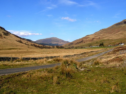
another in Lanarkshire)The Douglas Water rises only three quarters of a mile from Loch Long, but instead of dropping that short distance into Loch Long, it then runs nearly five mile east by southwards to enter Loch Lomond just a few yards north of Inverbeg Hotel. It forms an impressive small glen, with steep hills on both sides. On the north side there are Tullich Hill, Ben Vreac (2,233 ft) and Stob Goblach (1,413) while on the south are three hills over 2,000 feet - Doune Hill, Mid Hill and Ben Dubh. For nearly 100 years a drove road crossed Glen Douglas coming from Arrochar to Glen Fruin and then Stoneymollan, thereby avoiding the tolls on the A82. There are still a number of working farms in the Glen. It was its very steepness, which attracted its most notable residents - the Ministry of Defence. The Glen Douglas Depot was built from about 1960-63, and at the same time a small village was built to house workers at Depot. These houses were vacated nearly 20 years ago. Glen Douglas provides responsive and efficient munitions storage, maintenance and distribution support to UK Armed Forces. Logistic activity covers a wide range of conventional munitions in support of mainly the Royal Navy and Royal Air Force by way of repairs to the HM Ships and in the refurbishment of aircraft bombs and bomb tails. Additionally, the site operates a deep-water explosive handling depot, which is linked to an extensive road and MoD rail facility Douglas Water Hydroelectric Scheme is located on the north side of Loch Fyne, about 5 km south west of Inveraray in Argyllshire. The 3 megawatt (MW) development is a run of river scheme, utilising the water from Douglas Water itself and the tributary of Allt Fearna. At 3 MW, the scheme is expected to produce about 10gigawatt-hours(GWh) of energy each year, enough electricity to power about 2,000 homes. As the scheme does not have a storage reservoir, electricity is only produced when river levels are sufficiently high.
| |||||||||||||||||||||||||||
|
The content of this website is a collection of materials gathered from a variety of sources, some of it unedited. The webmaster does not intend to claim authorship, but gives credit to the originators for their work. As work progresses, some of the content may be re-written and presented in a unique format, to which we would then be able to claim ownership. Discussion and contributions from those more knowledgeable is welcome. Last modified: Friday, 02 August 2024 |